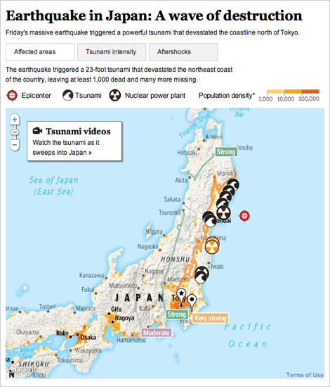
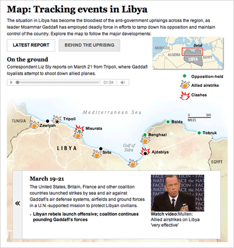
The past several weeks have been full of foreign news, and we have been producing lots of graphics to explain what’s happening. I have worked on these two graphics, one about the earthquake and subsequent tsunami in Japan, and one that explains what is going on in Libya.
For a full explanation of the process of creating the Japan graphic, visit the new Innovations blog at the WP (excerpted below):
Friday morning, as news of the earthquake in Japan spread, we started pulling together an interactive map that would show readers where and how events unfolded. Over the next 36 hours, we would continually expand and improve the information, design and interactivity of the map as the news of the earthquake and tsunami came in. Read more »
For Libya, we combined an event tracker with audio and video from the ground. The reports from correspondents on the ground is my favorite part.
Both graphics are done using javascript and jquery, so check them out on your tablet devices!

